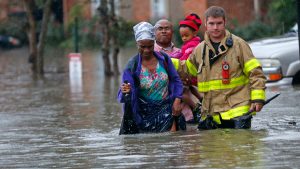
Public Safety
Whether you’re an incident commander or a first responder, seconds matter in making critical decisions that can impact lives during an emergency. Law enforcement, emergency management, search and rescue and all support services receive vast amounts of data from numerous sources that must be quickly integrated and analyzed. Effectively responding to a crime or crisis situation is only possible if this data is assimilated into something comprehensible that can be shared with others and used to mobilize resources.
 Now is the time to invest in GIS, a sophisticated mapping technology that has helped many organizations overcome operational challenges and drive improved profitability. It leverages all of the geographically-referenced data that exists in your corporate systems — such as neighbourhood statistics and demographics, imagery and sensor data, social media feeds and historic crime data- to uncover what might not otherwise be visible or understood in a multipage report or complex spreadsheet.
ArcGIS is a robust platform that allows you to manage, analyze and display your data so that you can make the best, most informed decisions. It gives everyone in your organization the ability to discover, use, make and share information and maps from any device, anywhere, anytime.